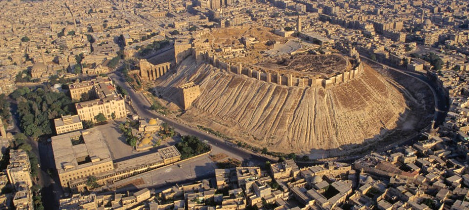
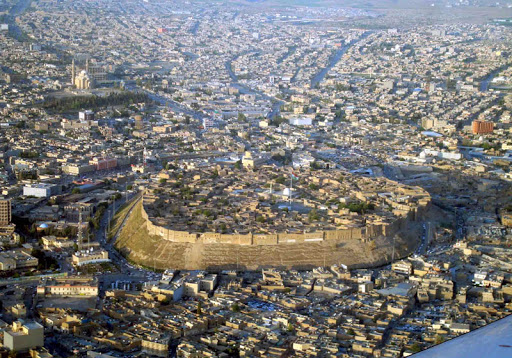
The Citadel of Erbil
The Citadel, is a hill or occupied mound, and the historical city centre of Erbil in the Kurdistan Region of Iraq. The citadel has been inscribed on the World Heritage List since 21 June 2014.
The earliest evidence for occupation of the citadel mound dates to the 5th millennium BC, and possibly earlier. It appears for the first time in historical sources in the Ebla tablets around 2,300 BC, and gained particular importance during the Neo-Assyrian period. During the Sassanian period and the Abbasid Caliphate, Erbil was an important centre for Christianity. After the Mongols captured the citadel in 1258, the importance of Erbil declined. During the 20th century, the urban structure was significantly modified, as a result of which a number of houses and public buildings were destroyed. In 2007, the High Commission for Erbil Citadel Revitalization (HCECR) was established to oversee the restoration of the citadel.
The buildings on top of the tell stretch over a roughly oval area of 430 by 340 meters (1,410 ft × 1,120 ft.) occupying 102,000 square meters (1,100,000 sq ft). The only religious structure that currently survives is the Mulla Afandi Mosque. The mound rises between 25 and 32 meters (82 and 105 ft) from the surrounding plain. When it was fully occupied, the citadel was divided in three districts or mahallas: from east to west the Serai, the Takya and the Topkhana. The Serai was occupied by notable families; the Takya district was named after the homes of dervishes, which are called takyas; and the Topkhana district housed craftsmen and farmers.